
Page 248 - Lanzarotto Malocello from Italy to the Canary Islands
P. 248
248 from Italy to the Canary Islands
Caddeo also points out that the Genoese (and consequently also the
other Italian navigators) were using different devices and not just charts
(which they called carte de navegar), which showed wind roses, coast out-
lines, the tides, etc., but also globes, which showed the full cosmography
of the then known lands. In addition, portolan charts were also known;
these are navigational maps that derive directly from the so-called “perip-
li” and show coastlines with landing points. This is obviously useful for
cabotage (i.e. navigation along the coast) and here we can mention the Lib-
th
er Rivierarum, from the late 13 century. This and other texts use the term
“peleggio” or “pileggio”, meaning the distance to be covered, and include
the direction of the cardinal points (in the Divine Comedy, Dante writes,
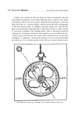
Astrolabe for marine use. Indicates a 35° zenith distance of the sun